
Day 120 - Mount Rainier

My morning began at 7am with a music festival parking lot wake up followed by a long drive south through incredibly beatiful scenary to Mount Rainier. I stopped by popular Lake Chelan, but it was too touristy and crowded for my liking. The lake just outside of Chelan was just as pretty and this viewpoint serene. 

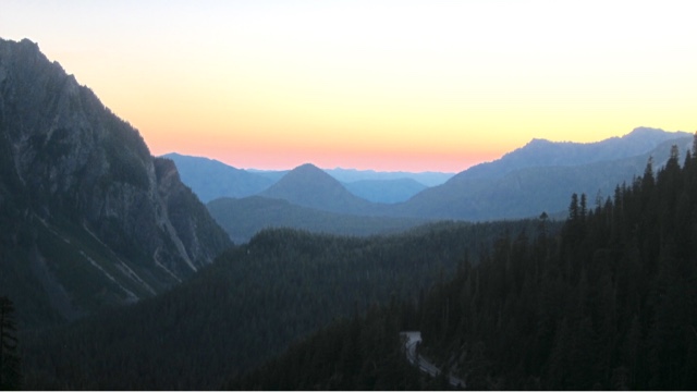
After six hours of driving I arrived at Mount Rainier. The viewpoint from White Pass was awe-inspiring. Rainier glowed proudly in the perfectly clear sky. 

Tired after a bit restless and short sleeping night, I found a quiet, shaded camping spot just outside the park, and napped until 530pm. Then I drove towards Paradise, the valley below the southern face of Rainier, known for its wildflowers. The road up to Paradise. 

I hiked a few short trails, enjoying the dusk light views of Rainier and her many glaciers, meadows and streams. 

The valley and Paradise Inn below. The famous wildflowers were almost all gone by this mid-July time due to the mountain receiving half of average snowfall. 

There was a special astronomy program starting at 945pm tonight.  They had a half dozen telescopes set up and promised great views of Saturn and the Milky Way and other star clusters. I found a lovey spot for a sunset and waited for the lights to go down. 

The view of Saturn was awesome: you could clearly see the bright rings circling the bright star. But she looked like a child's drawing from so far away. It wasn't until one of the volunteer astronomers hooked his digital SLR camera to his top-notch telescope that things got sciencerific. He took four separate two-minute exposures of the Lagoon nebula, then stitched them together and adjusted the lighting and color right there. 

After an hour, we had produced this image of the Lagoon Nebula, a baby star cluster being born! 


Comments

Popular posts from this blog

Day 161 - JMT Purple Lake and Tully Hole

We got our first glimpse of smoke far across the valley as we climbed higher. Up on a ridge after a morning climb, we followed a side trail to an open viewpoint beyond the trees. Selfie:) The smoke, while visible, seemed to give the mountains a blue glow-- like a highlighter to a sketch. You could still see the edges of the mountain ridges, the story of their creation. We could hike in this. But the smoke looked worse farther south. Or it was getting worse as time rolled incessantly forward.  On day two we had ran into a northbound hiker we nicknamed Speedy Steve. Speedy Steve had hiked 18 miles a day through eight consecutive smoke-filled days, including atleast three "very bad days" when he couldn't see the surrounding mountains, the sun glowed a haunting orange and ash accumulated overnight. On the way to Purple Lake we ran into three dirty, beat up, tired north-bound hikers with a similar story. They had to spend one night in an emergency hut at Muir Pass to avoid the...

Day 48 - Canyonlands Island in the Sky Pt 2

Mountain biking the 100-mile 4x4 White Rim Road is said to be a great American adventure. But without any water, you need a follow truck to carry your water and gear, and reservations must be made three months in advance. So I just decided to hike down 1500 feet to the white rim and hike the road a bit.  Steep, steep, steep was the descent down the Goosberry trail, but I reached the rim level in only 45 minutes!  I hiked further down to the white rim road and then past to the very edge. Looking around for a possible path down to the river bottom 1000 feet below was a fun task, but a hard one as the "white rim rock" has a solid sheer 50-150 feet dropoff. I found one possible path down but a lone Nalgene bottle left down below the white rocks indicated an aborted attempt down. I continued to walk the rim for a few hours, finally climbing a small Mesa edge to enjoy the high view of the other side.  After a brief respite, I walked back an hour along the Jeep 4x4 road to the G...

Day 41 - Escalante Coyote Gulch

This one or two night Coyote Gulch hike was an easy test of my newly learned navigation skills.  Anxious to get started I awoke at 545 just as the sun was rising.  I followed an obvious landmark, a tall thin spire called Chimney Rock, northwest to Hurricane Wash (a drainage running into Coyote Gulch).  After a couple of hours of walking up over and around slick rock, I entered the famous Coyote Gulch.  The walls around me raised up, darkened and th water flow increased--like nature hinting at the scenic beauty ahead.  The normally crowded Coyote Gulch was fairly empty on this early Thursday morning, giving the canyon a very peaceful and quiet feeling-- fragile almost. Down steam, I ran into the famous Jacob Hamilton Arch and then thirty minutes further-- the Coyote Natural Birdge. Both were beautiful due to their see through the wall character, but both would be overshadowed in my memory by the Stevens Arch tomorrow. Pics.  By 1pm, I had hiked for six hours...