
Day 38 - Escalante The Fin and Deer Creek

Waking up in the secret canyon felt special-- like a once in a lifetime moment you should cherish-- and we did with a breakfast and then a hike up the canyon on the opposite, easy sloping side. Andrew, Blake and I had scouted the exit the previous night and knew the group could ascend it. And they did. Once to the top, we broke off into agressive and non-agressive groups with brother Joshua joining Joel and the scouting party from yesterday. 

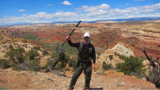
Aggressive group, nicknamed Group Intrepid by Joshua, and led by triathlete Canyoneering master Alan, set out to see if we could climb up the fin, a narrow ridge above the Escalante River we had past below on our first day. We used our navigation skills of reading a bearing on a map with true north and then applying to the field with magnetic north and set out. We slogged through soft sand and over slick rock and around trees for several hours and Alan showed us his tactic for saving time on hikes-- cutting through the end of drainages and ridges. This worked very well for the first several crossings but as we neared the fin close to the river the terrain got very ridgey. Maps only show changes greater than 40 feet of elevation so sometimes the micro terrain or ridges and valleys between those elevations can be difficult to navigate. A 10 foot shear dropoff is still un-passable. We pushed hard up and down and steered our way toward the base of the fin. Now facing a forty foot blockage we stopped, claimed a hard fought victory, and ate lunch and enjoyed  incredible vistas to our left and right. 


A quick forty five minute hike up brought us to the meeting place with the other group. Together we descended into the canyon following a route described in the guidebook. Again confused by the language (especially since this one was given for coming up not down) we stumbled a bit following the directions but eventually pushed our way down, finding a cairn marking a hidden side path down a drainage to the canyon bottom. Finding paths up and down canyon walls is super fun-- my favorite. 

Tired but knowing this was my last full day at the Escalante River, I joined a group to explore nearby Deer Creek. A quick hour and a half hike proved exceptionally tranquil. We passed a magical pothole with hanging gardens and water reflecting off the back wall, a wide and high side canyon valley with towering totems and the Bowington Arch, a rock span set high in the wall. 


On the return trip to camp, Alan decided the pothole was so gorgeous that he couldn't pass it without a swim, so he undressed and jumped in the cold water. Andrew followed suit and then when-in-Rome I jumped in, followed by Blake. A skinny dip in a magical pothole pond at Deer Creek was the perfect finale to a full crescendo of a day in Escalante. 


Comments

Popular posts from this blog

Day 104 - Glacier to Vancouver

The hike up Balu Pass was supposed to be fairly easy, beautiful and dotted with waterfalls, but when I talked to the park ranger and learned that Vancouver was an eight hour drive away, I decided to skip Balu and drive west.  I left behind this pretty view.  And drove many hours through pristine mountains, fewer and fewer snow-capped ones the further west I drove. Some of the valleys were flooded to make reservoirs, leaving scenic sights.  I eventually made it to Vancouver and drove right on through to Point Roberts USA, a five mile by five mile coastal land just below the 49th parallel and thus in the USA. The park ranger had suggested this as a good place to camp but being late of the Thursday night before the Fourth of July there were no spots available. I drove around instead and stopped at a forested coastal park. After ten minutes of walking I came to my first grand Pacific view with Mount Baker 60 miles east.  The San Juan Islands and Orca Islands could also b...

Day 122 - Mount Saint Helens

Mount Saint Helens is sinister and wonderful. I spent the morning at Rainier watching the end of the British Open on my phone, then drove south to Saint Helens.  I arrived at the park's northeast entrance by early afternoon.  A massive bulge of rock built up on the northeast side of the mountain before the 1980 eruption and then caused a tremendous landslide when the eruption started. I drove to the Windy Ridge at the end of the road, listened to a ranger describe before and after photos of the mountain, then hiked up to a high viewpoint.  You can see the circular ridge with a notch missing where the landslide occurred, the desert-like exposed right-side where the landslide blew away life and covered 15 miles of terrain with 150 feet of dirt and rock, the greenery that was on the lucky side of the eruption, and Spirit Lake which was covered by dirt and slime and fallen trees for years. The mountain was over a thousand feet higher before it erupted.  After taking in t...

Day 62 - Colorado National Monument

Established as a national monument early in 1911, Colorado NM is known for its high canyon "rim road" and sandstone spires of Monument Canyon.  The canyons of west Colorado are pretty--as they have more green trees and shrubs than the more famous Utah canyons. This gives them a more alive feeling, although the sandstone spires were formed many thousands of years ago by erosion.  Rim Rock road curves up the the top of the canyon cliff, goes through several round tunnels and is lined with scenic viewpoints. The best views were in he Monument Canyon section, and included in sequence, the Coke Ovens, The Kissing Couple (behind my head), and the most famous of all: Independence Monument, the tall spire in pic 3 and viewed from the side in pic 4.  The original promoter and caretaker of the park, John Otto, was the first person to climb Independence Monument and now it's a climbing right of passage. Every July 4 climbers ascend and mount an American flag at the summit. Fun! ...